In the dynamic field of infrastructure development, accurate and comprehensive data is crucial for the success of complex projects. Aerial mapping services have emerged as a transformative tool, providing innovative solutions and precise data that significantly enhance the planning, design, and execution of infrastructure projects. In this blog, we explore how aerial mapping services support infrastructure projects and why AOI Solutions is your go-to partner for these advanced surveying techniques.
The Power of Aerial Mapping Services
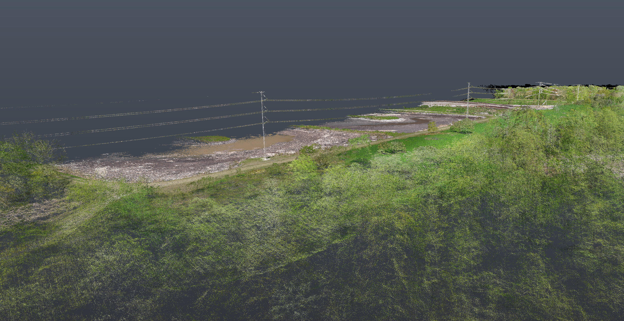
Aerial mapping involves the use of unmanned aircraft systems (UAS) equipped with advanced sensors and cameras to capture high-resolution images and data from above. This method offers a bird's-eye view of the project site, delivering detailed and accurate information that is otherwise difficult to obtain through traditional surveying methods.
By leveraging aerial mapping services, infrastructure projects can benefit from:
- Comprehensive Coverage: Aerial mapping covers large areas quickly and efficiently, providing a holistic view of the project site. This comprehensive coverage is essential for large-scale infrastructure projects such as highways, bridges, and urban developments.
- High-Resolution Data: The high-resolution imagery and data captured by aerial mapping provide unparalleled clarity and detail. This level of detail is crucial for identifying potential issues, planning construction phases, and ensuring accurate execution.
- Cost and Time Efficiency: Aerial mapping significantly reduces the time and cost associated with traditional ground-based surveying methods. The rapid data collection process allows for faster decision-making and project progression.
Applications in Infrastructure Projects
Aerial mapping services play a pivotal role in various stages of infrastructure projects, including:
- Planning and Design: During the initial planning and design phase, aerial mapping provides detailed topographic maps and 3D models that help engineers and architects understand the terrain and make informed decisions. These insights are crucial for designing infrastructure that is both functional and sustainable.
- Site Analysis and Feasibility Studies: Before construction begins, aerial mapping aids in conducting thorough site analyses and feasibility studies. This ensures that the chosen site is suitable for the intended infrastructure and helps identify any potential obstacles or challenges that need to be addressed.
- Construction Monitoring: Throughout the construction phase, aerial mapping services enable continuous monitoring of the project site. This real-time data allows project managers to track progress, ensure compliance with design specifications, and identify any deviations or issues that may arise.
- Inspection and Maintenance: After the completion of the infrastructure, aerial mapping continues to be valuable for regular inspections and maintenance. It helps in identifying wear and tear, structural integrity issues, and other maintenance needs, ensuring the longevity and safety of the infrastructure.
The AOI Solutions Advantage
At AOI Solutions, we specialize in providing top-notch aerial mapping services tailored to the unique needs of infrastructure projects. Our team of experienced professionals utilizes state-of-the-art UAS technology and high-resolution sensors to deliver precise and actionable data.
Here’s how we can support your infrastructure projects:
- Advanced Technology: Our UAS are equipped with the latest sensors, including high-resolution cameras, LiDAR, and multispectral imaging, ensuring the highest quality data.
- Expert Analysis: Our team of experts analyzes the data to provide you with detailed maps, models, and reports that support informed decision-making.
- Customized Solutions: We understand that every project is unique. We offer customized aerial mapping solutions that align with your specific project requirements and goals.
- Reliable Support: From planning to execution and maintenance, we provide continuous support to ensure the success of your infrastructure projects.
Enhance your infrastructure projects with the precision and efficiency of aerial mapping services. Trust AOI Solutions to provide the expertise and technology you need to achieve your project goals. Contact us today to learn more about our aerial mapping services and how we can help you succeed.
Ready to elevate your infrastructure projects with aerial mapping services? Contact AOI Solutions today to discuss your needs and get started.