In the construction industry, precision and accuracy are paramount. As projects become more complex and the need for efficiency grows, advanced technologies are transforming the way construction sites are surveyed and managed. Terrestrial scanning technology, also known as 3D laser scanning, is at the forefront of this transformation. In this blog, we discuss the latest advancements in terrestrial scanning technology and its impact on construction projects in Florida, enhancing accuracy and project outcomes.
The Evolution of Terrestrial Scanning Technology
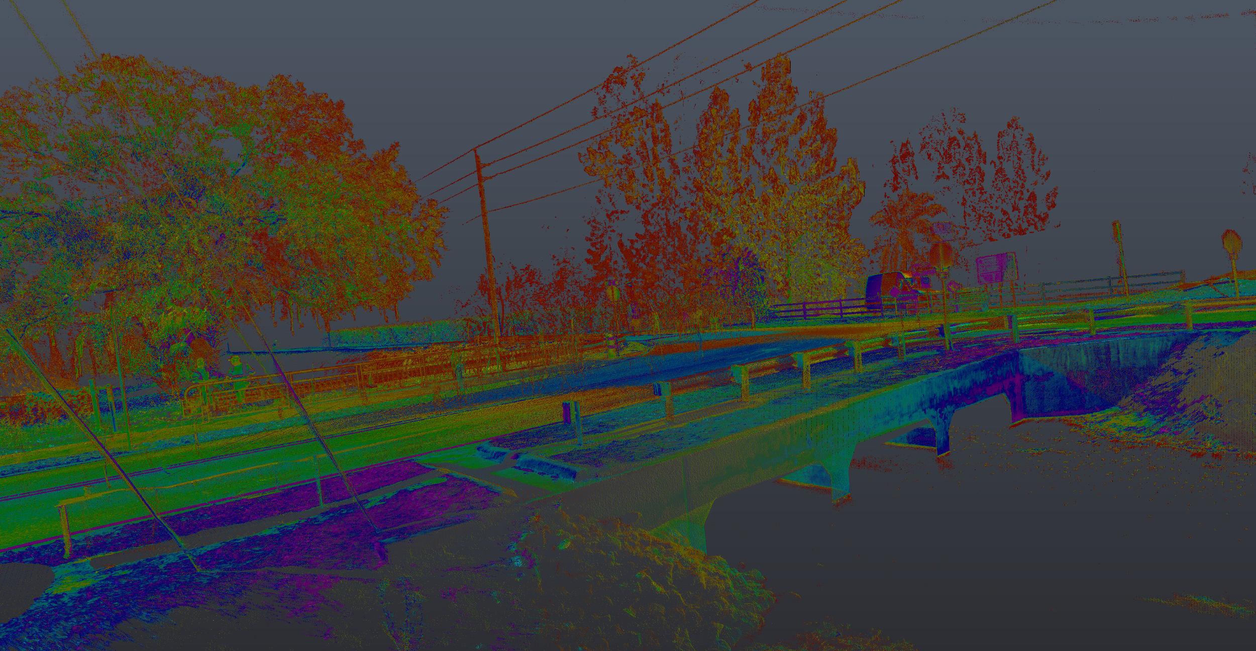
Terrestrial scanning technology uses laser pulses to capture detailed 3D information about the physical environment. This technology has evolved significantly, offering higher resolution, faster data capture, and greater accuracy. These advancements are revolutionizing the construction industry by providing precise data that supports every phase of a project.
In Florida, terrestrial scanning is used to:
- Conduct Site Surveys: Terrestrial scanning provides detailed topographic data and 3D models of construction sites. This information is crucial for site planning, design, and preparation.
- Monitor Construction Progress: By regularly scanning construction sites, project managers can monitor progress, compare it to design plans, and identify any deviations or issues early.
- Ensure Quality Control: Terrestrial scanning helps ensure that construction work meets design specifications and quality standards. This reduces the risk of errors and rework.
- Document As-Built Conditions: Scanning technology captures the exact conditions of a completed project, providing accurate as-built documentation for future reference and maintenance.
Applications of Terrestrial Scanning in Florida Construction
Highway and Infrastructure Projects: Terrestrial scanning supports the construction of highways, bridges, and other infrastructure by providing detailed data on site conditions, facilitating accurate design and construction.
Commercial and Residential Buildings: For commercial and residential buildings, terrestrial scanning ensures precise measurements and accurate construction, from the foundation to the final structure.
Industrial Facilities: In industrial construction, terrestrial scanning helps in the installation of equipment and machinery, ensuring precise placement and alignment.
Historical Preservation: Terrestrial scanning is also used in the preservation and restoration of historical buildings, capturing detailed data without disturbing the structures.
The AOI Solutions Advantage
At AOI Solutions, we specialize in providing state-of-the-art terrestrial scanning services tailored to the needs of the construction industry. Our team of experts uses the latest 3D laser scanning technology to deliver precise and actionable data that supports successful construction projects.
Here’s how we can support your construction projects:
- Advanced Technology: We use cutting-edge terrestrial scanning equipment to capture high-resolution data quickly and accurately.
- Expert Analysis: Our team of scanning specialists offers detailed analysis and interpretation of the data to support informed decision-making.
- Customized Solutions: We tailor our scanning services to meet the specific needs of each construction project, ensuring optimal outcomes.
- Quality Assurance: We are committed to ensuring that construction work meets the highest standards of quality and accuracy.
Transform your construction projects with the precision and efficiency of terrestrial scanning technology. Trust AOI Solutions to provide the expertise and technology you need to achieve your project goals. Contact us today to learn more about our terrestrial scanning services and how we can support your construction operations.